
1966 Map of Waseca
USGS Topo · Published 1967About this map
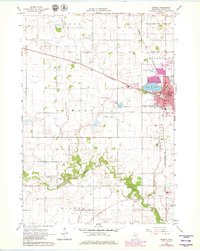
The regional hub of Waseca serves as the focal point of this mid-1960s survey, characterized by its position at the intersection of the Chicago and North Western railroad lines. The city plan shows a dense grid featuring the University of Minnesota (Southern Sch of Agr) and the Fairground, bordering the eastern shores of Loon Lake. To the south and west, the landscape transitions into the agricultural townships of St Mary and Wilton, where the Le Sueur River meanders through marshy lowlands like Senn Marsh. This era shows a well-established rural infrastructure, preserved through several family and parish grounds including St Mary Cem, Calvary Cem, and St Johns Cem. Industrial and transport markers of the period include the Deichen Landing Strip and localized Gravel Pits that supported the area's development.
Find a feature on this map
44 named features on this map. Tap any name to fly to it.
Don’t see what you’re looking for? This feature index may not catch every label — zoom into the map to look around manually.
Map Details
Editions of this 1966 Waseca Map
2 editions found
Other maps of this area

1953 · Saint Paul
USGS Topo · 1:250,000

1954 · Mason City
USGS Topo · 1:250,000

1957 · Mason City
USGS Topo · 1:250,000

1958 · Mason City
USGS Topo · 1:250,000

1959 · Saint Paul
USGS Topo · 1:250,000

1962 · Morristown
USGS Topo · 1:24,000

1962 · Meriden
USGS Topo · 1:24,000

1966 · Janesville
USGS Topo · 1:24,000

1966 · Waterville
USGS Topo · 1:24,000

1966 · Elysian
USGS Topo · 1:24,000