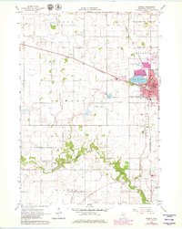
1966 Map of Waseca
USGS Topo · Published 1979About this map
Waseca serves as the regional hub for this mid-1960s survey, showing its growth as the county seat adjacent to Loon Lake. The landscape is defined by the winding course of the Le Sueur River in the south and an extensive network of managed water systems, including Co Ditch No 35 and Co Ditch No 38. This drainage infrastructure highlights the area's agricultural importance, further underscored by the presence of the University of Minnesota (Southern Sch of Agr) on the city's southern edge.
Find a feature on this map
34 named features on this map. Tap any name to fly to it.
Don’t see what you’re looking for? This feature index may not catch every label — zoom into the map to look around manually.
Map Details
Editions of this 1966 Waseca Map
2 editions found
Other maps of this area

1953 · Saint Paul
USGS Topo · 1:250,000

1954 · Mason City
USGS Topo · 1:250,000

1957 · Mason City
USGS Topo · 1:250,000

1958 · Mason City
USGS Topo · 1:250,000

1959 · Saint Paul
USGS Topo · 1:250,000

1962 · Morristown
USGS Topo · 1:24,000

1962 · Meriden
USGS Topo · 1:24,000

1966 · Waseca
USGS Topo · 1:24,000

1966 · Janesville
USGS Topo · 1:24,000

1966 · Waterville
USGS Topo · 1:24,000