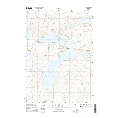
2016 Map of Elysian
USGS Topo · Published 2016About this map
The small lakeside communities of Greenland and Elysian anchor this 2016 survey along the boundary of Le Sueur and Waseca Counties. The landscape is defined by an intricate network of glacial lakes, including the sprawling Lake Francis and the dual-labeled waters of Elysian Lake and Lake Elysian. Prominent shoreline features such as Clarks Point, Sextons Point, and Savages Point illustrate the irregular topography shaped by the region’s hydrology. Near the town of Elysian, the terrain includes the notable Dove Lakebed and Klondike Hill, while the Cannon River flows through the northeastern corner past Tetonka Lake.
Find a feature on this map
81 named features on this map. Tap any name to fly to it.
Don’t see what you’re looking for? This feature index may not catch every label — zoom into the map to look around manually.
Map Details
Editions of this 2016 Elysian Map
This is the sole edition of this map. No revisions or reprints were ever made.
Other maps of this area

1950 · Mankato East
USGS Topo · 1:62,500

1951 · Mankato East
USGS Topo · 1:62,500

1953 · Saint Paul
USGS Topo · 1:250,000

1959 · Saint Paul
USGS Topo · 1:250,000

1965 · Cleveland
USGS Topo · 1:24,000

1966 · Waseca
USGS Topo · 1:24,000

1966 · Janesville
USGS Topo · 1:24,000

1966 · Waterville
USGS Topo · 1:24,000

1966 · Cordova
USGS Topo · 1:24,000

1966 · Elysian
USGS Topo · 1:24,000