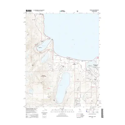
2015 Map of Emerald Bay
USGS Topo · Published 2015About this map
South Lake Tahoe and the southwestern shores of Lake Tahoe are defined by deep glacial carvings and rising peaks within the Eldorado National Forest. This 2015 survey details the dense development around Tahoe Keys and Tallac Village alongside the expansive natural basins of Emerald Bay and Fallen Leaf Lake. The intricate shoreline includes landmarks like Fannette Island and Rubicon Point, while the interior terrain is marked by the Pacific Crest National Scenic Trail as it winds past Gilmore Lake and Cathedral Peak. Settlement patterns show a clear transition from the urbanized Lake Valley to the more isolated outposts at Fallen Leaf and Glen Alpine Spring. The map documents the extensive road network, from Emerald Bay Rd to the suburban residential grids of Tahoe Valley, illustrating the intersection of recreation and high-altitude living in El Dorado County.
Find a feature on this map
98 named features on this map. Tap any name to fly to it.
Don’t see what you’re looking for? This feature index may not catch every label — zoom into the map to look around manually.
Map Details
Editions of this 2015 Emerald Bay Map
This is the sole edition of this map. No revisions or reprints were ever made.
Other maps of this area

1889 · Pyramid Peak
USGS Topo · 1:125,000

1889 · Markleeville
USGS Topo · 1:125,000

1891 · Carson
USGS Topo · 1:125,000

1891 · Markleeville
USGS Topo · 1:125,000

1891 · Truckee
USGS Topo · 1:125,000

1891 · Pyramid Peak
USGS Topo · 1:125,000

1893 · Carson
USGS Topo · 1:125,000

1893 · Markleeville
USGS Topo · 1:125,000

1893 · Truckee
USGS Topo · 1:125,000

1895 · Pyramid Peak
USGS Topo · 1:125,000