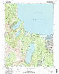
1992 Map of Emerald Bay
USGS Topo · Published 1994About this map
Lake Tahoe dominates the northeastern portion of this study, revealing a landscape defined by the intersection of recreational development and protected wilderness in the early 1990s. The shoreline is punctuated by historic landmarks such as Vikingsholm and the busy resort docks at Camp Richardson. To the south, the settlement of South Lake Tahoe exhibits a structured street grid including Tallac Village and Tahoe Valley, while the more secluded Fallen Leaf community sits at the edge of its namesake Fallen Leaf Lake.
Find a feature on this map
60 named features on this map. Tap any name to fly to it.
Don’t see what you’re looking for? This feature index may not catch every label — zoom into the map to look around manually.
Map Details
Editions of this 1992 Emerald Bay Map
This is the sole edition of this map. No revisions or reprints were ever made.
Other maps of this area

1889 · Pyramid Peak
USGS Topo · 1:125,000

1889 · Markleeville
USGS Topo · 1:125,000

1891 · Carson
USGS Topo · 1:125,000

1891 · Markleeville
USGS Topo · 1:125,000

1891 · Truckee
USGS Topo · 1:125,000

1891 · Pyramid Peak
USGS Topo · 1:125,000

1893 · Carson
USGS Topo · 1:125,000

1893 · Markleeville
USGS Topo · 1:125,000

1893 · Truckee
USGS Topo · 1:125,000

1895 · Pyramid Peak
USGS Topo · 1:125,000
Featured Places
- South Lake Tahoe, CA
- Tahoe Valley, South Lake Tahoe
- Camp Richardson, CA
- Kiva Beach, CA
- Tahoe Keys, South Lake Tahoe