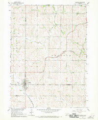
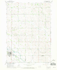
1967 Map of Emerson
USGS Topo · Published 1969About this map
Emerson sits at a geographic crossroads in the late 1960s, positioned where Dixon, Dakota, and Thurston counties meet. The settlement’s development is closely tied to the Chicago and North Western railroad, which arcs through the landscape to serve the local agricultural economy. This survey captures a specific cultural boundary as the Winnebago Indian Reservation Boundary cuts across the southern portion of the map, separating the township of Emerson from the lands of Perry.
Find a feature on this map
19 named features on this map. Tap any name to fly to it.
Don’t see what you’re looking for? This feature index may not catch every label — zoom into the map to look around manually.
Map Details
Editions of this 1967 Emerson Map
2 editions found
Other maps of this area

1955 · Sioux City
USGS Topo · 1:250,000

1958 · Sioux City
USGS Topo · 1:250,000

1959 · Sioux City
USGS Topo · 1:250,000

1966 · Thurston
USGS Topo · 1:24,000

1966 · Altona NE
USGS Topo · 1:24,000

1966 · Pender NE
USGS Topo · 1:24,000

1967 · Waterbury
USGS Topo · 1:24,000
1967 · Allen
USGS Topo · 1:24,000
1967 · Jackson
USGS Topo · 1:24,000
1967 · Wakefield
USGS Topo · 1:24,000