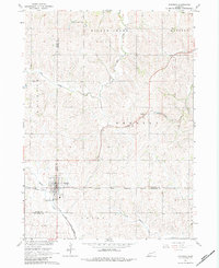
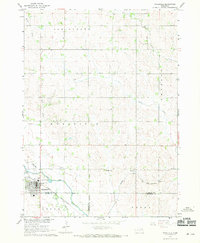
1967 Map of Emerson
USGS Topo · Published 1984About this map
The tri-county junction of Dixon, Dakota, and Thurston counties forms the backdrop for this mid-century portrait of Emerson. Situated at the intersection of several regional drainages, the landscape is defined by the winding paths of Elk Creek, Middle Creek, and North Omaha Creek. The Chicago and North Western railroad cuts diagonally across the terrain, serving the small community of Nacora and the grain-and-rail economy of northeastern Nebraska. A notable historical marker on this map is the Winnebago Indian Reservation Boundary, which runs along the southern portion of the quadrangle. Genealogists may find interest in local landmarks such as Jopp Cem and the detailed street grid of the village of Emerson, including infrastructure like a Substation and Sewage Disposal plant.
Find a feature on this map
18 named features on this map. Tap any name to fly to it.
Don’t see what you’re looking for? This feature index may not catch every label — zoom into the map to look around manually.
Map Details
Editions of this 1967 Emerson Map
2 editions found
Other maps of this area

1955 · Sioux City
USGS Topo · 1:250,000

1958 · Sioux City
USGS Topo · 1:250,000

1959 · Sioux City
USGS Topo · 1:250,000

1966 · Thurston
USGS Topo · 1:24,000

1966 · Altona NE
USGS Topo · 1:24,000

1966 · Pender NE
USGS Topo · 1:24,000

1967 · Waterbury
USGS Topo · 1:24,000
1967 · Allen
USGS Topo · 1:24,000
1967 · Jackson
USGS Topo · 1:24,000
1967 · Wakefield
USGS Topo · 1:24,000