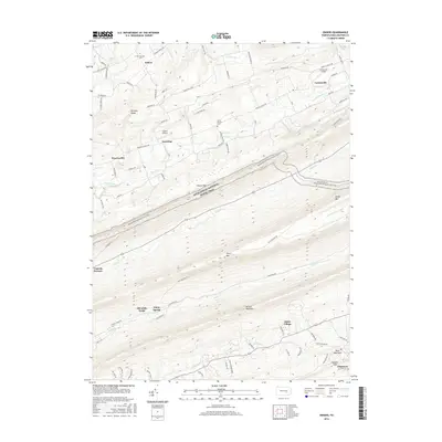
2016 Map of Enders
USGS Topo · Published 2016About this map
The industrial and natural heritage of Dauphin County is clearly etched into this modern survey, defined by the parallel ridges of Peters Mtn, Third Mtn, and Second Mountain. Evidence of early ironworking remains at Victoria Furnace and Ellendale Forge, sites that were once vital to the regional economy. The landscape is bisected by the Appalachian National Scenic Trail, which follows the high crest of the mountains, overlooking a series of valley settlements including Enders, Enterline, and Waynesville. The map also captures several distinctive local landmarks, from the boulder-strewn Devils Race Course to the small rural airstrips at Carsonville Airport and Gusler Airport. Genealogists may find value in the locations of Fairview Cem and Union Church Cem, which serve the clustered communities along Powells Valley Rd and Carsonville Rd.
Find a feature on this map
90 named features on this map. Tap any name to fly to it.
Don’t see what you’re looking for? This feature index may not catch every label — zoom into the map to look around manually.
Map Details
Editions of this 2016 Enders Map
This is the sole edition of this map. No revisions or reprints were ever made.
Other maps of this area

1892 · Lykens
USGS Topo · 1:62,500

1892 · Hummelstown
USGS Topo · 1:62,500

1892 · Harrisburg
USGS Topo · 1:62,500

1893 · Lykens
USGS Topo · 1:62,500

1893 · Millersburg
USGS Topo · 1:62,500

1899 · Harrisburg
USGS Topo · 1:62,500

1924 · Hummelstown
USGS Topo · 1:62,500

1924 · Harrisburg
USGS Topo · 1:62,500

1943 · Millersburg
USGS Topo · 1:62,500

1943 · Lykens
USGS Topo · 1:62,500
Featured Places
- Ellendale Forge, Middle Paxton Township
- Ritzie Village, West Hanover Township
- Enterline, Wayne Township
- Wayne Township, PA
- West Hanover Township, PA