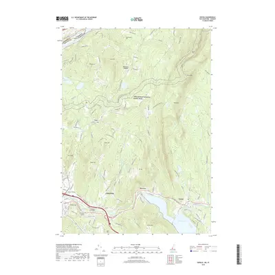
2018 Map of Enfield
USGS Topo · Published 2018About this map
Appalachian National Scenic Trail winds through a landscape of high ridges and narrow valleys between the Connecticut River and the Mascoma watershed. This 2018 survey documents the varied topography of central Grafton County, where the highlands of Moose Mtn, Mt Tug, and Shaker Mtn overlook established settlements. In the southern portion of the map, the industrial and residential corridors of Lebanon and Enfield are shaped by the Mascoma River and the expansive Mascoma Lake. In the north, the small village of Etna and the rural crossroads of Hanover Center remain centered around agricultural land and protected water resources like the Hanover Reservoirs. Local landmarks such as the Packard Hill Bridge and the Upper Valley Educators Institute reflect the area's continued role as an educational and transit hub within the Upper Valley region.
Find a feature on this map
114 named features on this map. Tap any name to fly to it.
Don’t see what you’re looking for? This feature index may not catch every label — zoom into the map to look around manually.
Map Details
Editions of this 2018 Enfield Map
This is the sole edition of this map. No revisions or reprints were ever made.
Other maps of this area

1896 · Strafford
USGS Topo · 1:62,500

1906 · Hanover
USGS Topo · 1:62,500

1908 · Hanover
USGS Topo · 1:62,500

1927 · Mascoma
USGS Topo · 1:62,500

1931 · Mt. Cube
USGS Topo · 1:62,500

1932 · Mascoma
USGS Topo · 1:62,500

1933 · Mt. Cube
USGS Topo · 1:62,500

1944 · Strafford
USGS Topo · 1:62,500

1950 · Glens Falls
USGS Topo · 1:250,000

1956 · Glens Falls
USGS Topo · 1:250,000