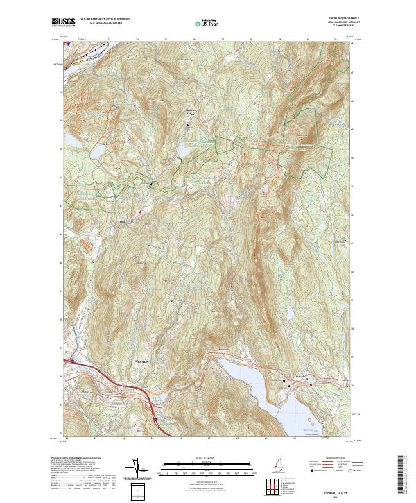
2024 Map of Enfield
USGS Topo · Published 2024About this map
Hanover Center and Etna anchor the northern reaches of this New Hampshire landscape, where the Appalachian National Scenic Trail traverses the heights of South Peak and North Peak on Moose Mountain. The terrain is defined by a series of prominent summits, including Hayes Hill, Huntington Hill, and Shaker Mountain, while the southern portion of the map is dominated by the waters of Mascoma Lake and the industrial-era corridor of the Northern Rail Trl.
Find a feature on this map
129 named features on this map. Tap any name to fly to it.
Don’t see what you’re looking for? This feature index may not catch every label — zoom into the map to look around manually.
Map Details
Editions of this 2024 Enfield Map
This is the sole edition of this map. No revisions or reprints were ever made.
Other maps of this area

1896 · Strafford
USGS Topo · 1:62,500

1906 · Hanover
USGS Topo · 1:62,500

1908 · Hanover
USGS Topo · 1:62,500

1927 · Mascoma
USGS Topo · 1:62,500

1931 · Mt. Cube
USGS Topo · 1:62,500

1932 · Mascoma
USGS Topo · 1:62,500

1933 · Mt. Cube
USGS Topo · 1:62,500

1944 · Strafford
USGS Topo · 1:62,500

1950 · Glens Falls
USGS Topo · 1:250,000

1956 · Glens Falls
USGS Topo · 1:250,000