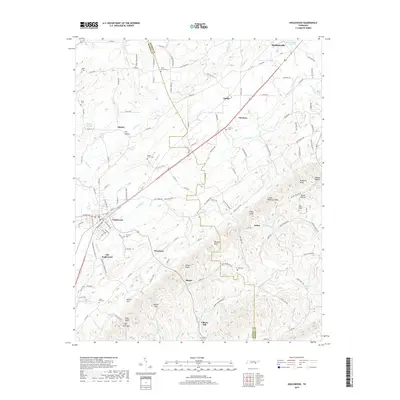
2019 Map of Englewood
USGS Topo · Published 2019About this map
Englewood and Old Englewood anchor this 2019 survey of the McMinn and Monroe County borderlands. The landscape transitions from the developed corridor around Madisonville Lake in the north toward the high relief of the Unicoi foothills, marked by summits such as Luther Bookout Knob and Johnson Knob. The historical imprint of the Old Federal Rd is clearly visible, cutting across the terrain and linking small crossroads like Gudger, Nonaburg, and Arden. Numerous rural cemeteries, including Saint Marys Cem and Mars Hill Cem, are preserved here, providing essential data for genealogical research. The drainage patterns of Chestuee Cr and its tributaries, such as Little Chestuee Cr and Beaver Branch, define the agricultural valleys between the ridges, where small settlements like Manila and Burger maintain their distinct local identities amidst the ridges and hollows.
Find a feature on this map
122 named features on this map. Tap any name to fly to it.
Don’t see what you’re looking for? This feature index may not catch every label — zoom into the map to look around manually.
Map Details
Editions of this 2019 Englewood Map
This is the sole edition of this map. No revisions or reprints were ever made.
Other maps of this area

1886 · Cleveland
USGS Topo · 1:125,000

1887 · Kingston
USGS Topo · 1:125,000

1891 · Kingston
USGS Topo · 1:125,000

1892 · Cleveland
USGS Topo · 1:125,000

1893 · Murphy
USGS Topo · 1:125,000

1893 · Kingston
USGS Topo · 1:125,000

1895 · Cleveland
USGS Topo · 1:125,000

1895 · Loudon
USGS Topo · 1:125,000

1901 · Cleveland
USGS Topo · 1:125,000

1914 · Murphy
USGS Topo · 1:125,000