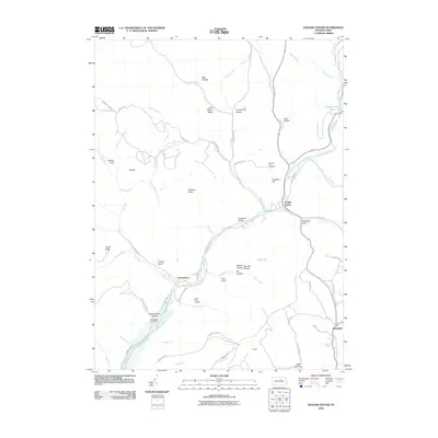
2010 Map of English Center
USGS Topo · Published 2010About this map
English Center and Carsontown sit along the winding course of Little Pine Creek in this northern Pennsylvania landscape. The region is defined by deeply carved drainages and ridges, including Chestnut Ridge and Longs Ridge, where numerous small runs like Otter Run and English Run feed the larger creek system. Local history is anchored by sites like Carsontown Cemetery and the Dowling Hill Cemetery, reflecting the small settlements that have long occupied these narrow valleys.
Find a feature on this map
66 named features on this map. Tap any name to fly to it.
Don’t see what you’re looking for? This feature index may not catch every label — zoom into the map to look around manually.
Map Details
Editions of this 2010 English Center Map
This is the sole edition of this map. No revisions or reprints were ever made.
Other maps of this area

1921 · Trout Run
USGS Topo · 1:62,500

1923 · Trout Run
USGS Topo · 1:62,500

1925 · Blossburg
USGS Topo · 1:62,500

1927 · Blossburg
USGS Topo · 1:62,500

1935 · Waterville
USGS Topo · 1:24,000

1937 · Waterville
USGS Topo · 1:48,000

1943 · Waterville
USGS Topo · 1:62,500

1944 · Blossburg
USGS Topo · 1:62,500

1944 · Trout Run
USGS Topo · 1:62,500

1946 · Antrim
USGS Topo · 1:62,500
Featured Places
- Pine Township, PA
- Brookside, Cogan House Township
- Brown Township, PA
- Cogan House Township, PA
- McHenry Township, PA