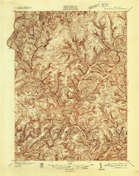
1937 Map of Waterville
USGS Topo · Published 1937About this map
Pine Creek carves a deep valley through this pre-war landscape, serving as a primary corridor for the New York Central railroad and the concentrated settlements of Cammal and Waterville. The surrounding uplands are defined by a complex network of forestry trails and depression-era labor, evidenced by the presence of CCC Camp No 129 and a hilltop Fire Tower. While the valleys support commerce and transport, the ridges are dotted with isolated community hubs like Okome, where the Okome Sch and Okome Cem served local residents.
Find a feature on this map
91 named features on this map. Tap any name to fly to it.
Don’t see what you’re looking for? This feature index may not catch every label — zoom into the map to look around manually.
Map Details
Editions of this 1937 Waterville Map
5 editions found
Historical Maps of Gallagher Township Through Time
52 maps found

1921 Trout Run
Lycoming County, PA

1923 Trout Run
Lycoming County, PA

1930 Warrensville
Lycoming County, PA

1934 Warrensville
Lycoming County, PA

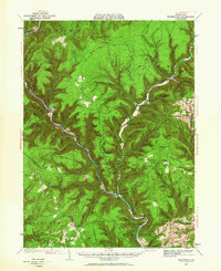
1935 Waterville
Lycoming County, PA

1937 Waterville
Lycoming County, PA

1943 Waterville
Lycoming County, PA

1944 Trout Run
Lycoming County, PA

1946 Slate Run
Lycoming County, PA

1948 Slate Run
Lycoming County, PA

1953 Warrensville
Lycoming County, PA

1965 Barbours
Lycoming County, PA

1965 Bodines
Lycoming County, PA

1965 Cammal
Lycoming County, PA

1965 Cogan Station
Lycoming County, PA

1965 English Center
Lycoming County, PA

1965 Huntersville
Lycoming County, PA

1965 Jersey Mills
Lycoming County, PA

1965 Linden
Lycoming County, PA

1965 Montoursville North
Lycoming County, PA

1965 Montoursville South
Lycoming County, PA

1965 Trout Run
Lycoming County, PA

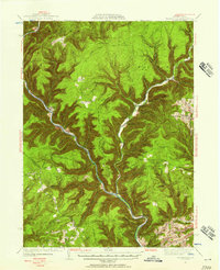
1965 Waterville
Lycoming County, PA

1965 White Pine
Lycoming County, PA

1969 Grover
Lycoming County, PA

1969 Ralston
Lycoming County, PA

1977 Ralston
Lycoming County, PA

1984 Williamsport East
Lycoming County, PA

1994 Cammal
Lycoming County, PA

1994 Cogan Station
Lycoming County, PA

1994 English Center
Lycoming County, PA

1994 Montoursville South
Lycoming County, PA

1994 Slate Run
Lycoming County, PA

1994 Waterville
Lycoming County, PA

1995 Barbours
Lycoming County, PA

1999 Montoursville North
Lycoming County, PA

2023 Barbours
Lycoming County, PA

2023 Bodines
Lycoming County, PA

2023 Cammal
Lycoming County, PA

2023 Cogan Station
Lycoming County, PA

2023 English Center
Lycoming County, PA

2023 Grover
Lycoming County, PA

2023 Huntersville
Lycoming County, PA

2023 Jersey Mills
Lycoming County, PA

2023 Linden
Lycoming County, PA

2023 Montoursville North
Lycoming County, PA

2023 Montoursville South
Lycoming County, PA

2023 Ralston
Lycoming County, PA

2023 Slate Run
Lycoming County, PA

2023 Trout Run
Lycoming County, PA

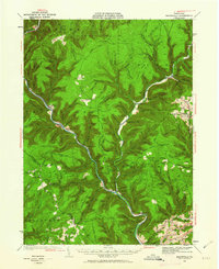
2023 Waterville
Lycoming County, PA

2023 White Pine
Lycoming County, PA
Featured Locations
- Gallagher Township, PA
- Cogan House Township, PA
- Mifflin Township, PA
- Brookside, Cogan House Township
- Carsontown, Pine Township