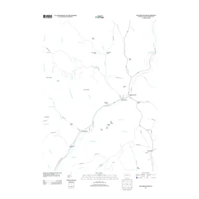
2013 Map of English Center
USGS Topo · Published 2013About this map
The English Center Suspension Bridge spans the waters near the small settlement of English Center, a central point in this Lycoming County landscape. The area is defined by its complex drainage network, where Little Pine Cr is joined by numerous runs and forks, including English Run and Bonnell Run. Settlement patterns are concentrated along these valley corridors, notably at Carsontown and Brookside, while the surrounding uplands like Jake Shanty Ridge and Chestnut Ridge remain largely undeveloped. The presence of Little Pine State Park and features such as Schoolhouse Hollow and Layton Draft suggest a history of localized rural industry and land management. The winding paths of Little Pine Creek Rd and McKees Run Rd trace the narrow habitable floors between steep hollows.
Find a feature on this map
78 named features on this map. Tap any name to fly to it.
Don’t see what you’re looking for? This feature index may not catch every label — zoom into the map to look around manually.
Map Details
Editions of this 2013 English Center Map
This is the sole edition of this map. No revisions or reprints were ever made.
Other maps of this area

1921 · Trout Run
USGS Topo · 1:62,500

1923 · Trout Run
USGS Topo · 1:62,500

1925 · Blossburg
USGS Topo · 1:62,500

1927 · Blossburg
USGS Topo · 1:62,500

1935 · Waterville
USGS Topo · 1:24,000

1937 · Waterville
USGS Topo · 1:48,000

1943 · Waterville
USGS Topo · 1:62,500

1944 · Blossburg
USGS Topo · 1:62,500

1944 · Trout Run
USGS Topo · 1:62,500

1946 · Antrim
USGS Topo · 1:62,500
Featured Places
- Pine Township, PA
- Brookside, Cogan House Township
- Brown Township, PA
- Cogan House Township, PA
- McHenry Township, PA