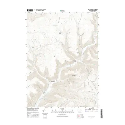
2016 Map of English Center
USGS Topo · Published 2016About this map
Little Pine Creek carves a deep valley through the high ridges of northern Lycoming County, creating a landscape defined by steep drafts and winding hollows. The settlement of English Center serves as a focal point where the historic English Center Suspension Bridge spans the water, connecting the community to the network of winding forest roads. To the west, the smaller hamlet of Carsontown sits near Carsontown Cem and Otter Run, while Brookside occupies the southern reach along the Second Fork Larrys Cr. The terrain is marked by distinctive local nomenclature reflecting early timbering and land use, seen in names like Jake Shanty Ridge, Shingle Mill Br, and Schoolhouse Hollow. These family-named landmarks and remote hollows, such as Yutdmark Hollow and Jack Cammels Camp Run, provide an intricate look at the geography of the Pennsylvania Wilds.
Find a feature on this map
73 named features on this map. Tap any name to fly to it.
Don’t see what you’re looking for? This feature index may not catch every label — zoom into the map to look around manually.
Map Details
Editions of this 2016 English Center Map
This is the sole edition of this map. No revisions or reprints were ever made.
Other maps of this area

1921 · Trout Run
USGS Topo · 1:62,500

1923 · Trout Run
USGS Topo · 1:62,500

1925 · Blossburg
USGS Topo · 1:62,500

1927 · Blossburg
USGS Topo · 1:62,500

1935 · Waterville
USGS Topo · 1:24,000

1937 · Waterville
USGS Topo · 1:48,000

1943 · Waterville
USGS Topo · 1:62,500

1944 · Blossburg
USGS Topo · 1:62,500

1944 · Trout Run
USGS Topo · 1:62,500

1946 · Antrim
USGS Topo · 1:62,500
Featured Places
- Pine Township, PA
- Brookside, Cogan House Township
- Brown Township, PA
- Cogan House Township, PA
- McHenry Township, PA