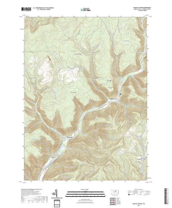
2023 Map of English Center
USGS Topo · Published 2023About this map
Little Pine Creek carves a deep valley through this Lycoming County landscape, anchoring the small settlements of English Center and Carsontown. The topography is defined by sharp ridges and deep hollows, including Chestnut Ridge and Lick Draft, illustrating the difficult terrain that historical residents navigated. Local genealogy is well-preserved through several family and community burial sites such as the English Center Cem, Carsontown Cem, and Hill Cem near Dowling Hill. The map traces a network of remote roads and paths, from the Mid State Trl to the ATV/Disabled Person Route Trl, highlighting the area's transition into a modern recreational corridor while maintaining its traditional footprint. Names like Jake Shanty Ridge and Jack Gammals Camp Run hint at the personal histories and small-scale camps that once dotted these woods.
Find a feature on this map
71 named features on this map. Tap any name to fly to it.
Don’t see what you’re looking for? This feature index may not catch every label — zoom into the map to look around manually.
Map Details
Editions of this 2023 English Center Map
This is the sole edition of this map. No revisions or reprints were ever made.
Other maps of this area

1921 · Trout Run
USGS Topo · 1:62,500

1923 · Trout Run
USGS Topo · 1:62,500

1925 · Blossburg
USGS Topo · 1:62,500

1927 · Blossburg
USGS Topo · 1:62,500

1935 · Waterville
USGS Topo · 1:24,000

1937 · Waterville
USGS Topo · 1:48,000

1943 · Waterville
USGS Topo · 1:62,500

1944 · Blossburg
USGS Topo · 1:62,500

1944 · Trout Run
USGS Topo · 1:62,500

1946 · Antrim
USGS Topo · 1:62,500
Featured Places
- McHenry Township, PA
- Cummings Township, PA
- Pine Township, PA
- English Center, Pine Township
- Brookside, Cogan House Township