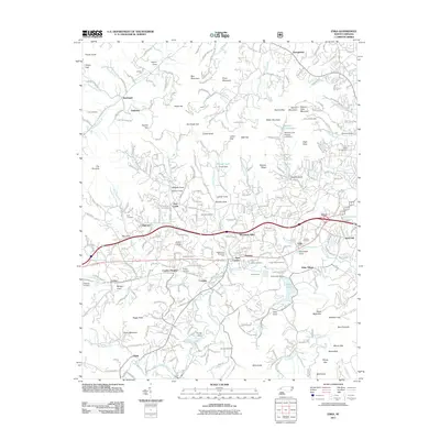
2011 Map of Enka
USGS Topo · Published 2011About this map
Candler and the surrounding Buncombe County landscape are depicted here at a period of established suburban and industrial development west of Asheville. The map centers on the Hominy Creek valley, where the legacy of the American Enka Company is visible through Enka Village, Enka Lake, and the Enka Quarry. Residential expansion is evident in neighborhoods like Woodside Hills and Candler Heights, while the transportation corridor of Us HWY 19-23 and the Southern railroad line dictate the layout of local commerce. Genealogists will find a high density of burial sites including Pisgah View Memorial Park, Gudger Cemetery, and Harkins Cemetery. The terrain is defined by numerous coves and gaps, such as Milksick Cove and Spivey Gap, illustrating how the community integrated with the ridges of Piney Mountain and Deaver View Mountain.
Find a feature on this map
97 named features on this map. Tap any name to fly to it.
Don’t see what you’re looking for? This feature index may not catch every label — zoom into the map to look around manually.
Map Details
Editions of this 2011 Enka Map
This is the sole edition of this map. No revisions or reprints were ever made.
Other maps of this area

1894 · Asheville
USGS Topo · 1:125,000

1901 · Asheville
USGS Topo · 1:125,000

1905 · Pisgah
USGS Topo · 1:125,000

1906 · Pisgah
USGS Topo · 1:125,000

1935 · Cruso
USGS Topo · 1:24,000

1935 · Canton
USGS Topo · 1:24,000

1936 · Sandymush
USGS Topo · 1:24,000

1936 · Enka
USGS Topo · 1:24,000

1936 · Weaverville
USGS Topo · 1:24,000

1936 · Skyland
USGS Topo · 1:24,000