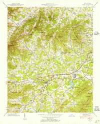
1941 Map of Enka
USGS Topo · Published 1956About this map
Hominy Creek defines the industrial and residential development of this Buncombe County landscape, where the Southern railway line runs parallel to the waterway. This era of mapping shows the early footprint of Enka and Enka Village alongside the expansive Enka Lake, illustrating the intersection of manufacturing and local life. To the west, the landscape transitions into the smaller rural settlements of Candler and Luthers, surrounded by a high density of community institutions including Westland Ch, Liberty Ch, and the Pisgah Industrial Institute.
Find a feature on this map
99 named features on this map. Tap any name to fly to it.
Don’t see what you’re looking for? This feature index may not catch every label — zoom into the map to look around manually.
Map Details
Editions of this 1941 Enka Map
This is the sole edition of this map. No revisions or reprints were ever made.
Other maps of this area

1894 · Asheville
USGS Topo · 1:125,000

1901 · Asheville
USGS Topo · 1:125,000

1905 · Pisgah
USGS Topo · 1:125,000

1906 · Pisgah
USGS Topo · 1:125,000

1935 · Cruso
USGS Topo · 1:24,000

1935 · Canton
USGS Topo · 1:24,000

1936 · Sandymush
USGS Topo · 1:24,000

1936 · Enka
USGS Topo · 1:24,000

1936 · Weaverville
USGS Topo · 1:24,000

1936 · Skyland
USGS Topo · 1:24,000