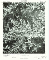
1976 Map of Enka
USGS Topo · Published 1979About this map
Asheville serves as the eastern anchor of this 1970s orthophotoquad, which captures the industrial and residential development spreading west through Buncombe County. The settlement of Enka is prominent near the center of the sheet, situated along the corridor of Hominy Creek and the man-made Enka Lake. This transition from urban density to rural valley is bracketed by significant high ground, including Lookout Mountain to the west and Scott Mountain to the southeast. The aerial imagery provides a clear view of the mid-century transportation network and industrial footprint in Candler before later decades of suburban expansion. Unlike traditional topographic maps, this rectified photo imagery shows the actual land use and vegetation patterns of the Appalachian foothills in the years following the peak of the local textile industry.
Find a feature on this map
8 named features on this map. Tap any name to fly to it.
Don’t see what you’re looking for? This feature index may not catch every label — zoom into the map to look around manually.
Map Details
Editions of this 1976 Enka Map
This is the sole edition of this map. No revisions or reprints were ever made.
Other maps of this area

1894 · Asheville
USGS Topo · 1:125,000

1901 · Asheville
USGS Topo · 1:125,000

1905 · Pisgah
USGS Topo · 1:125,000

1906 · Pisgah
USGS Topo · 1:125,000

1935 · Cruso
USGS Topo · 1:24,000

1935 · Canton
USGS Topo · 1:24,000

1936 · Sandymush
USGS Topo · 1:24,000

1936 · Enka
USGS Topo · 1:24,000

1936 · Weaverville
USGS Topo · 1:24,000

1936 · Skyland
USGS Topo · 1:24,000