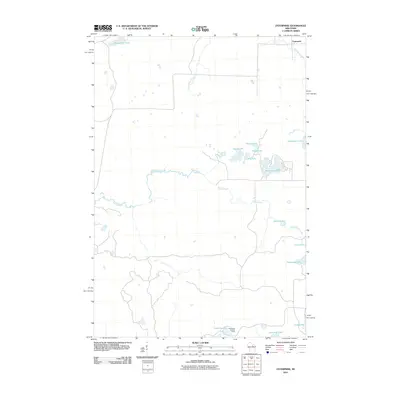
2010 Map of Enterprise
USGS Topo · Published 2010About this map
The Enterprise settlement anchors the northeast corner of this landscape, which is defined by a dense network of glacial lakes and the winding course of the Prairie River. This 2010 topographic record shows a region dominated by water and woodland management, where the Basswood Lookout Tower stands as a prominent landmark for forest observation near the southern boundary. The drainage pattern is complex, with Pine Needle Creek and Enterprise Creek feeding into a chain of water bodies including Enterprise Lake, Moccasin Lake, and the small Bog Lake. In the northwest, Shingle Mill Lake suggests the area's legacy of timber processing, while the southern reaches feature specifically named locations like Townline Lake and Dynamite Lake. The map details a quiet, rural interior reached by a handful of local roads that navigate between the many small basins like Round Lake and Perch Lake.
Find a feature on this map
18 named features on this map. Tap any name to fly to it.
Don’t see what you’re looking for? This feature index may not catch every label — zoom into the map to look around manually.
Map Details
Editions of this 2010 Enterprise Map
This is the sole edition of this map. No revisions or reprints were ever made.
Other maps of this area

1940 · Parrish
USGS Topo · 1:48,000

1940 · Monico
USGS Topo · 1:48,000

1940 · Rhinelander
USGS Topo · 1:48,000

1942 · Elcho
USGS Topo · 1:48,000

1949 · Rhinelander
USGS Topo · 1:48,000

1950 · Monico
USGS Topo · 1:48,000

1950 · Elcho
USGS Topo · 1:48,000

1950 · Parrish
USGS Topo · 1:48,000

1952 · Parrish
USGS Topo · 1:48,000

1954 · Iron Mountain
USGS Topo · 1:250,000