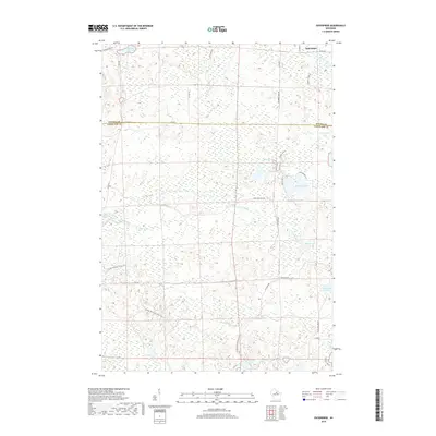
2018 Map of Enterprise
USGS Topo · Published 2018About this map
The Ice Age National Scenic Trail winds through this 2018 survey of the borderlands between Oneida and Langlade Counties. This landscape is defined by its glacial legacy, featuring a dense network of kettle lakes and wetlands. The settlement of Enterprise sits in the northeast corner, connected by a network of rural routes like Co Hwy Q and Planert Creek Rd. Significant water bodies such as Moccasin Lake, Shingle Mill Lake, and Townline Lake dominate the terrain, while the Prairie River meanders through the central marshes. The area remains largely defined by its natural features and forestry-focused infrastructure, with numerous unpaved access points like Lily Mill Fl and Five Cent Rd providing entry into the dense timber and swamp of the northern Wisconsin woods.
Find a feature on this map
33 named features on this map. Tap any name to fly to it.
Don’t see what you’re looking for? This feature index may not catch every label — zoom into the map to look around manually.
Map Details
Editions of this 2018 Enterprise Map
This is the sole edition of this map. No revisions or reprints were ever made.
Other maps of this area

1940 · Parrish
USGS Topo · 1:48,000

1940 · Monico
USGS Topo · 1:48,000

1940 · Rhinelander
USGS Topo · 1:48,000

1942 · Elcho
USGS Topo · 1:48,000

1949 · Rhinelander
USGS Topo · 1:48,000

1950 · Monico
USGS Topo · 1:48,000

1950 · Elcho
USGS Topo · 1:48,000

1950 · Parrish
USGS Topo · 1:48,000

1952 · Parrish
USGS Topo · 1:48,000

1954 · Iron Mountain
USGS Topo · 1:250,000