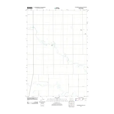
2011 Map of Enterprise School
USGS Topo · Published 2011About this map
Chanta Peta Creek meanders through this portion of Hettinger County, defining the rural character of the North Dakota prairie. The landscape is organized by a sparse network of section roads like 19th Ave NW and 72nd St SW, which connect isolated homesteads and small burial grounds that anchor the local community history. Genealogists and historians will find significant landmarks in the scattered cemeteries, including Tepee Butte Cemetery in the northeast and Saint Helena Cemetery near the central creek bed. To the south, Cedar Creek and the marshy reaches of Russian Slough provide natural drainage and topographic contrast to the surrounding agricultural plains. The arrangement of these watercourses and local cemeteries like Peace Cemetery illustrates the enduring settlement patterns of the Great Plains in the early 21st century.
Find a feature on this map
12 named features on this map. Tap any name to fly to it.
Don’t see what you’re looking for? This feature index may not catch every label — zoom into the map to look around manually.
Map Details
Editions of this 2011 Enterprise School Map
This is the sole edition of this map. No revisions or reprints were ever made.
Other maps of this area

1953 · Dickinson
USGS Topo · 1:250,000

1957 · Dickinson
USGS Topo · 1:250,000

1973 · Liens Dams
USGS Topo · 1:24,000

1973 · Cedar Lake
USGS Topo · 1:24,000

1973 · Jung Lake
USGS Topo · 1:24,000

1973 · Havelock
USGS Topo · 1:24,000

1973 · East Rainy Butte
USGS Topo · 1:24,000

1973 · Enterprise School
USGS Topo · 1:24,000

1980 · Mott
USGS Topo · 1:100,000
2011 · Jung Lake
USGS Topo · 1:24,000