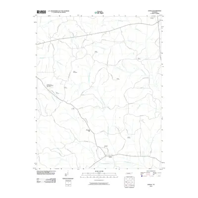
2010 Map of Enville
USGS Topo · Published 2010About this map
Enville and Pleasant Hill anchor this rural West Tennessee landscape, defined by a dense network of country roads and family-named cemeteries. The terrain is characterized by numerous watercourses, including the north-flowing Little White Oak Creek and the southern White Oak Creek, which drain the area surrounding the prominent Sand Mountain.
Find a feature on this map
55 named features on this map. Tap any name to fly to it.
Don’t see what you’re looking for? This feature index may not catch every label — zoom into the map to look around manually.
Map Details
Editions of this 2010 Enville Map
This is the sole edition of this map. No revisions or reprints were ever made.
Other maps of this area

1936 · Leapwood
USGS Topo · 1:24,000

1936 · Sardis
USGS Topo · 1:24,000

1936 · Reagan
USGS Topo · 1:24,000

1936 · Milledgeville
USGS Topo · 1:24,000

1936 · Enville
USGS Topo · 1:24,000

1936 · Life
USGS Topo · 1:24,000

1936 · Mt. Peter
USGS Topo · 1:24,000

1949 · Leapwood
USGS Topo · 1:24,000

1949 · Mt. Peter
USGS Topo · 1:24,000
1949 · Sardis
USGS Topo · 1:24,000