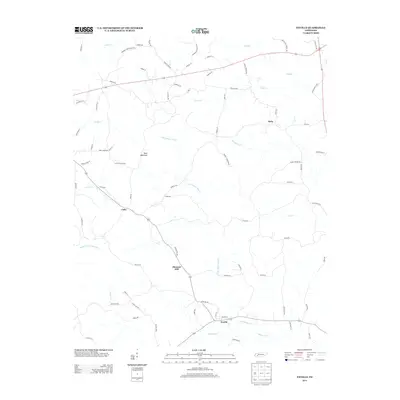
2013 Map of Enville
USGS Topo · Published 2013About this map
Enville anchors the southeastern corner of this West Tennessee landscape, where a dense network of local roads and creeks defines the rural character of Chester County. The terrain transitions from the lowlands of White Oak Creek up toward the prominence of Sand Mountain in the central region. Small settlements like Roby, Pleasant Hill, and Cabo are linked by winding routes such as Old Lula Rd and Roby Rd, reflecting a long-standing pattern of dispersed agricultural communities.
Find a feature on this map
82 named features on this map. Tap any name to fly to it.
Don’t see what you’re looking for? This feature index may not catch every label — zoom into the map to look around manually.
Map Details
Editions of this 2013 Enville Map
This is the sole edition of this map. No revisions or reprints were ever made.
Other maps of this area

1936 · Leapwood
USGS Topo · 1:24,000

1936 · Sardis
USGS Topo · 1:24,000

1936 · Reagan
USGS Topo · 1:24,000

1936 · Milledgeville
USGS Topo · 1:24,000

1936 · Enville
USGS Topo · 1:24,000

1936 · Life
USGS Topo · 1:24,000

1936 · Mt. Peter
USGS Topo · 1:24,000

1949 · Leapwood
USGS Topo · 1:24,000

1949 · Mt. Peter
USGS Topo · 1:24,000
1949 · Sardis
USGS Topo · 1:24,000