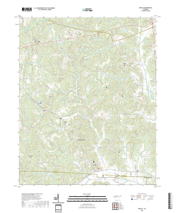
2022 Map of Enville
USGS Topo · Published 2022About this map
Enville sits at the heart of this landscape where the boundaries of Henderson, Chester, and McNairy counties meet. The terrain is defined by the Tennessee Valley Divide and the headwaters of numerous small streams including Little White Oak Cr and Middleton Creek. The area retains a distinct rural character, with clusters of family cemeteries like Johnsons Gross Roads Cem and Stewart Cem serving as significant genealogical markers for the region. The settlement pattern is largely shaped by the winding route of Old State Hwy 22A, which connects smaller communities such as Cabo and Pleasant Hill. Notable topographic features like Sand Mountain rise above the surrounding creek valleys, while the southeastern corner reaches toward Milledgeville.
Find a feature on this map
95 named features on this map. Tap any name to fly to it.
Don’t see what you’re looking for? This feature index may not catch every label — zoom into the map to look around manually.
Map Details
Editions of this 2022 Enville Map
This is the sole edition of this map. No revisions or reprints were ever made.
Other maps of this area

1936 · Leapwood
USGS Topo · 1:24,000

1936 · Sardis
USGS Topo · 1:24,000

1936 · Reagan
USGS Topo · 1:24,000

1936 · Milledgeville
USGS Topo · 1:24,000

1936 · Enville
USGS Topo · 1:24,000

1936 · Life
USGS Topo · 1:24,000

1936 · Mt. Peter
USGS Topo · 1:24,000

1949 · Leapwood
USGS Topo · 1:24,000

1949 · Mt. Peter
USGS Topo · 1:24,000
1949 · Sardis
USGS Topo · 1:24,000