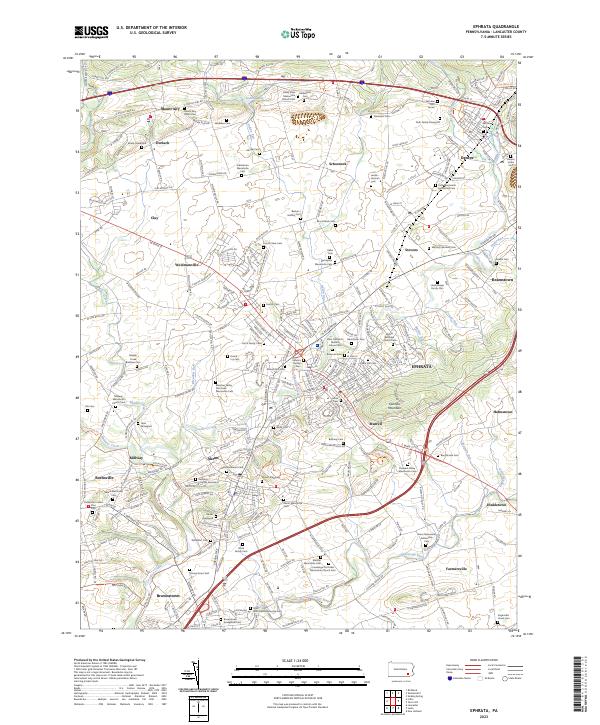
2023 Map of Ephrata
USGS Topo · Published 2023About this map
The Ephrata area of Lancaster County reveals a landscape deeply intertwined with the heritage of the Plain sects, characterized by a high density of Mennonite and Brethren meeting houses and cemeteries. From the historic Ephrata Cloister Cem to the Conestoga Old Order Mennonite Church Cem, the map documents the religious geography of Pennsylvania Dutch country. The terrain is defined by the prominent Ephrata Mountain and a complex network of waterways including Middle Creek, Cocalico Creek, and the Conestoga River. Small settlements like Schoeneck, Reamstown, and Rothsville are linked by a mix of modern infrastructure like I-76 and traditional footpaths such as the Conestoga Trl. For genealogists, the map is an exceptional resource, capturing small burial grounds like the Ruth Family Graveyard and the Eberly Graveyard that might otherwise be overlooked.
Find a feature on this map
88 named features on this map. Tap any name to fly to it.
Don’t see what you’re looking for? This feature index may not catch every label — zoom into the map to look around manually.
Map Details
Editions of this 2023 Ephrata Map
This is the sole edition of this map. No revisions or reprints were ever made.
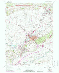
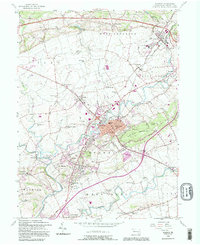
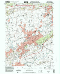
Historical Maps of Ephrata Township Through Time
4 maps found