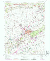
1956 Map of Ephrata
USGS Topo · Published 1989About this map
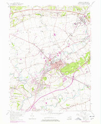
Ephrata and its surrounding townships define this Lancaster County landscape, where the Cocalico Creek winds past concentrated industrial and residential development. The map illustrates a transitional period of growth, anchored by the prominent Ephrata Mountain and the critical transportation corridor of the Pennsylvania Turnpike running across the northern reaches. This 1956 survey, updated with photo-inspected details from the early 1980s, reveals a dense network of local institutions that served the agricultural and growing suburban communities, including numerous country schoolhouses like Washington Sch and Fulton Sch.
Find a feature on this map
68 named features on this map. Tap any name to fly to it.
Don’t see what you’re looking for? This feature index may not catch every label — zoom into the map to look around manually.
Map Details
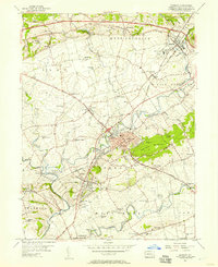
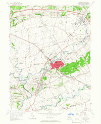
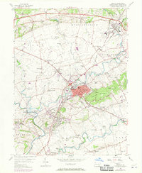
Editions of this 1956 Ephrata Map
5 editions found
Other maps of this area

1891 · Lebanon
USGS Topo · 1:62,500

1893 · Lebanon
USGS Topo · 1:62,500

1899 · Lebanon
USGS Topo · 1:62,500

1902 · Wernersville
USGS Topo · 1:62,500

1902 · Lancaster
USGS Topo · 1:62,500

1904 · Lancaster
USGS Topo · 1:62,500

1906 · New Holland
USGS Topo · 1:62,500

1908 · New Holland
USGS Topo · 1:62,500

1941 · New Holland
USGS Topo · 1:62,500

1943 · Lancaster
USGS Topo · 1:62,500