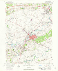
1956 Map of Ephrata
USGS Topo · Published 1970About this map
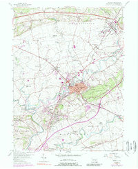
Ephrata and its surrounding boroughs define this mid-century landscape in Lancaster County, where the transition from traditional Pennsylvania German farmsteads to modern infrastructure is clearly visible. The Reading railroad line and the Pennsylvania Turnpike cut through the terrain, illustrating the region's importance as a transportation corridor. Numerous small schools such as Metzler Sch and Fetter Sch appear alongside a high density of country churches like Zion Ch and Hans Graf Ch, reflecting the deep-rooted community life of the local townships.
Find a feature on this map
74 named features on this map. Tap any name to fly to it.
Don’t see what you’re looking for? This feature index may not catch every label — zoom into the map to look around manually.
Map Details
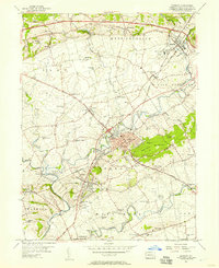
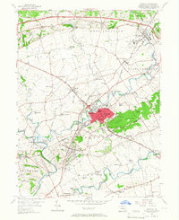
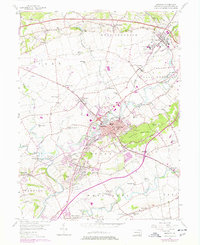
Editions of this 1956 Ephrata Map
5 editions found
Other maps of this area

1891 · Lebanon
USGS Topo · 1:62,500

1893 · Lebanon
USGS Topo · 1:62,500

1899 · Lebanon
USGS Topo · 1:62,500

1902 · Wernersville
USGS Topo · 1:62,500

1902 · Lancaster
USGS Topo · 1:62,500

1904 · Lancaster
USGS Topo · 1:62,500

1906 · New Holland
USGS Topo · 1:62,500

1908 · New Holland
USGS Topo · 1:62,500

1941 · New Holland
USGS Topo · 1:62,500

1943 · Lancaster
USGS Topo · 1:62,500