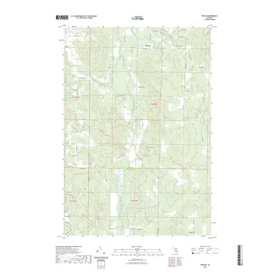
2023 Map of Epsilon
USGS Topo · Published 2023About this map
The settlement of Epsilon sits at a crossroads in the northern portion of this landscape, situated near the headwaters of Silver Creek and the small Silver Creek Pond. The terrain transitions across the Emmet County and Charlevoix County line, characterized by high points like Gray Hill and Chandler Hill. This region is defined by its complex drainage network, where the West Branch Minnehaha Creek joins the main Minnehaha Creek and the North Branch Spring Brook flows southward through the timbered sections.
Find a feature on this map
77 named features on this map. Tap any name to fly to it.
Don’t see what you’re looking for? This feature index may not catch every label — zoom into the map to look around manually.
Map Details
Editions of this 2023 Epsilon Map
This is the sole edition of this map. No revisions or reprints were ever made.
Other maps of this area

1954 · Gaylord
USGS Topo · 1:62,500

1955 · Cheboygan
USGS Topo · 1:250,000

1957 · Wolverine
USGS Topo · 1:62,500

1958 · Cheboygan
USGS Topo · 1:250,000

1958 · Petoskey
USGS Topo · 1:62,500

1961 · Boyne Falls
USGS Topo · 1:62,500

1975 · Petoskey NW
USGS Topo · 1:24,000

1975 · Petoskey SW
USGS Topo · 1:24,000

1975 · Petoskey NE
USGS Topo · 1:24,000

1982 · Petoskey
USGS Topo · 1:100,000