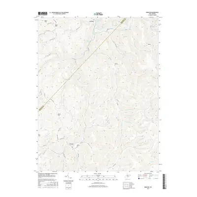
2016 Map of Erbacon
USGS Topo · Published 2016About this map
Centralia and Erbacon anchor this rugged stretch of the Braxton and Webster County line, where the topography is defined by the deep incisions of Laurel Creek and the Little Birch River. The northern landscape is influenced by the waters of Sutton Lake, with several mountain ridges like Barker Ridge and Spring Ridge rising steeply from the narrow hollows. The settlement pattern follows the drainages and ridge tops, connected by a network of rural routes including Centralia Road and Erbacon Road. Genealogists and local historians will find significant points of interest at the Centralia Cemetery and McCourt-Cogar Cemetery, alongside Sunset Memorial Park in the south. This area, marked by prominent high points such as Pilot Knob and Big Mountain, reflects the enduring rural character of central West Virginia's coal and timber country.
Find a feature on this map
52 named features on this map. Tap any name to fly to it.
Don’t see what you’re looking for? This feature index may not catch every label — zoom into the map to look around manually.
Map Details
Editions of this 2016 Erbacon Map
This is the sole edition of this map. No revisions or reprints were ever made.
Other maps of this area

1889 · Nicholas
USGS Topo · 1:125,000

1891 · Nicholas
USGS Topo · 1:125,000

1891 · Huntersville
USGS Topo · 1:125,000

1893 · Buckhannon
USGS Topo · 1:125,000

1893 · Sutton
USGS Topo · 1:125,000

1894 · Huntersville
USGS Topo · 1:125,000

1896 · Buckhannon
USGS Topo · 1:125,000

1897 · Buckhannon
USGS Topo · 1:125,000

1901 · Nicholas
USGS Topo · 1:125,000

1908 · Sutton
USGS Topo · 1:48,000