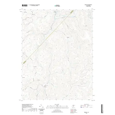
2019 Map of Erbacon
USGS Topo · Published 2019About this map
Centralia and Erbacon anchor this detailed survey of the rugged borderlands between Braxton and Webster counties. The landscape is defined by the sharp relief of Barker Ridge and Poplar Ridge in the north, giving way to the winding course of the Elk River as it enters Sutton Lake. This area reflects a classic Appalachian settlement pattern, where narrow hollows carved by Laurel Creek, Camp Cr, and Houston Run dictate the placement of local roads and family homesteads. For those tracing regional roots, the map identifies local landmarks such as Centralia Cem, the McCourt-Cogar Cem, and Sunset Memorial Park near Erbacon. The network of secondary routes, including Coal Mine Rd and Centralia Rd, underscores the historical importance of resource extraction and transit in this deeply dissected terrain.
Find a feature on this map
54 named features on this map. Tap any name to fly to it.
Don’t see what you’re looking for? This feature index may not catch every label — zoom into the map to look around manually.
Map Details
Editions of this 2019 Erbacon Map
This is the sole edition of this map. No revisions or reprints were ever made.
Other maps of this area

1889 · Nicholas
USGS Topo · 1:125,000

1891 · Nicholas
USGS Topo · 1:125,000

1891 · Huntersville
USGS Topo · 1:125,000

1893 · Buckhannon
USGS Topo · 1:125,000

1893 · Sutton
USGS Topo · 1:125,000

1894 · Huntersville
USGS Topo · 1:125,000

1896 · Buckhannon
USGS Topo · 1:125,000

1897 · Buckhannon
USGS Topo · 1:125,000

1901 · Nicholas
USGS Topo · 1:125,000

1908 · Sutton
USGS Topo · 1:48,000