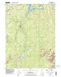
1997 Map of Erbacon
USGS Topo · Published 2003About this map
Centralia and the northern reaches of the Elk River State Wildlife Management Area define the landscape of this late-twentieth-century survey. Situated at the confluence of the Elk River and Mill Creek, Centralia serves as a focal point near Sutton Lake, which is noted as subject to controlled inundation. Further south, the settlements of Prestonia and Erbacon follow the winding course of Laurel Creek, illustrating the traditional valley-bottom settlement patterns of the region.
Find a feature on this map
43 named features on this map. Tap any name to fly to it.
Don’t see what you’re looking for? This feature index may not catch every label — zoom into the map to look around manually.
Map Details
Editions of this 1997 Erbacon Map
This is the sole edition of this map. No revisions or reprints were ever made.
Other maps of this area

1889 · Nicholas
USGS Topo · 1:125,000

1891 · Nicholas
USGS Topo · 1:125,000

1891 · Huntersville
USGS Topo · 1:125,000

1893 · Buckhannon
USGS Topo · 1:125,000

1893 · Sutton
USGS Topo · 1:125,000

1894 · Huntersville
USGS Topo · 1:125,000

1896 · Buckhannon
USGS Topo · 1:125,000

1897 · Buckhannon
USGS Topo · 1:125,000

1901 · Nicholas
USGS Topo · 1:125,000

1908 · Sutton
USGS Topo · 1:48,000