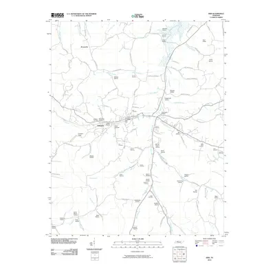
2010 Map of Erin
USGS Topo · Published 2010About this map
The Erin Post Office serves as the central hub for this portion of Houston County, where the terrain is defined by a dense network of branching creeks and named hollows. The settlement patterns follow the winding paths of Wells Creek and its many tributaries, including Musterground Creek and Spring Branch. This landscape is particularly notable for its many family-named cemeteries, such as the Kennedy Cemetery, McMillian Cemetery, and Alsobrook Cemetery, which provide valuable location data for genealogists tracking local lineages. Small residential clusters like Arlington and Brownsville are connected by a web of narrow roads that thread through geographical features like Arlington Ridge and Rocky Hollow. The presence of the Schmid Airport in the north and the numerous named hollows—including Secret Prayer Hollow and Tantrough Hollow—reflect a rural community deeply rooted in its local topography.
Find a feature on this map
111 named features on this map. Tap any name to fly to it.
Don’t see what you’re looking for? This feature index may not catch every label — zoom into the map to look around manually.
Map Details
Editions of this 2010 Erin Map
This is the sole edition of this map. No revisions or reprints were ever made.
Other maps of this area

1931 · Erin
USGS Topo · 1:62,500

1936 · Tantrough Hollow
USGS Topo · 1:24,000

1936 · Woolworth
USGS Topo · 1:24,000

1936 · Ruskin
USGS Topo · 1:24,000

1936 · Stewart
USGS Topo · 1:24,000

1936 · Halls Creek
USGS Topo · 1:24,000

1936 · Dover
USGS Topo · 1:24,000

1950 · Halls Creek
USGS Topo · 1:24,000

1950 · Stewart
USGS Topo · 1:24,000

1950 · Dover
USGS Topo · 1:24,000