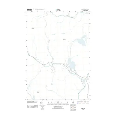
2012 Map of Errol
USGS Topo · Published 2012About this map
The town of Errol sits at the confluence of the Androscoggin River and Clear Stream in Coos County, serving as a primary settlement point in this northern New Hampshire landscape. The area is defined by a complex network of waterways, including the Swift Diamond River which flows past Palmers Cabin and over Ellingwood Falls in the northern portion of the quadrangle. High points like Black Mountain, Signal Mountain, and Rice Mountain overlook a terrain punctuated by numerous remote water bodies such as Akers Pond, Greenough Pond, and Sweat Pond. The presence of the Errol Airport and roads like the Hampshire Woods Loop and Errol Dam Rd highlight the regional transportation and forestry infrastructure, while smaller labels such as Squeeze Hole Brook and Smoky Camp Brook suggest the specific nomenclature of local hunting and logging history.
Find a feature on this map
34 named features on this map. Tap any name to fly to it.
Don’t see what you’re looking for? This feature index may not catch every label — zoom into the map to look around manually.
Map Details
Editions of this 2012 Errol Map
This is the sole edition of this map. No revisions or reprints were ever made.
Other maps of this area

1930 · Milan
USGS Topo · 1:62,500

1930 · Percy
USGS Topo · 1:62,500

1930 · Dixville
USGS Topo · 1:62,500

1930 · Errol
USGS Topo · 1:62,500

1933 · Dixville
USGS Topo · 1:62,500

1933 · Milan
USGS Topo · 1:62,500

1934 · Percy
USGS Topo · 1:62,500

1934 · Dixville
USGS Topo · 1:62,500

1934 · Errol
USGS Topo · 1:62,500

1934 · Milan
USGS Topo · 1:62,500