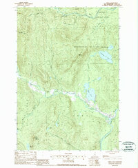
1988 Map of Errol
USGS Topo · Published 1988About this map
Errol sits at the confluence of Clear Stream and the Androscoggin River in this late-1980s landscape of Coos County. The township boundaries of Dixville, Dixs Grant, Second College Grant, and Wentworths Location converge in this densely wooded region, highlighting the unique land grant history of northern New Hampshire. Water dominates the terrain, from the large expanse of Greenough Pond and Akers Pond to the winding course of the Swift Diamond River as it passes Ellingwood Falls. High elevations like Black Mountain and Signal Mountain, which features a prominent Signal Tower, overlook a network of brooks including Larys Brook and Corser Brook. The presence of the Woods Scenic Area along the river south of the main settlement suggests the area's transition into a recreational and conservation-focused corridor during this era.
Find a feature on this map
31 named features on this map. Tap any name to fly to it.
Don’t see what you’re looking for? This feature index may not catch every label — zoom into the map to look around manually.
Map Details
Editions of this 1988 Errol Map
This is the sole edition of this map. No revisions or reprints were ever made.
Other maps of this area

1930 · Milan
USGS Topo · 1:62,500

1930 · Percy
USGS Topo · 1:62,500

1930 · Dixville
USGS Topo · 1:62,500

1930 · Errol
USGS Topo · 1:62,500

1933 · Dixville
USGS Topo · 1:62,500

1933 · Milan
USGS Topo · 1:62,500

1934 · Percy
USGS Topo · 1:62,500

1934 · Dixville
USGS Topo · 1:62,500

1934 · Errol
USGS Topo · 1:62,500

1934 · Milan
USGS Topo · 1:62,500