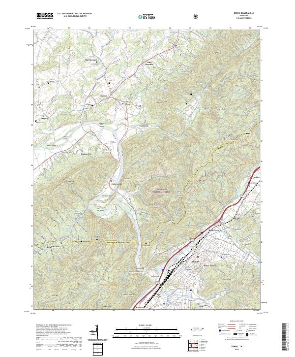
2022 Map of Erwin
USGS Topo · Published 2022About this map
The Nolichucky River carves a winding path through this corner of Unicoi County, serving as the central axis for historical settlements and industrial sites. In the southern reach, Erwin serves as the focal point, featuring the Unicoi County Courthouse and the extensive grounds of the Erwin National Fish Hatchery. The map captures a landscape defined by deep ridges and hollows, such as Bumpus Cove and Hulan Hollow, where local family names are preserved in landmarks like Garland Cem and Jobe Cem.
Find a feature on this map
184 named features on this map. Tap any name to fly to it.
Don’t see what you’re looking for? This feature index may not catch every label — zoom into the map to look around manually.
Map Details
Editions of this 2022 Erwin Map
This is the sole edition of this map. No revisions or reprints were ever made.
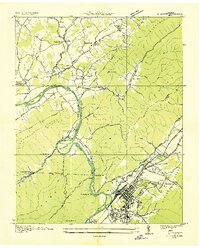
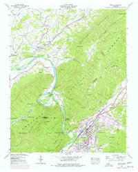
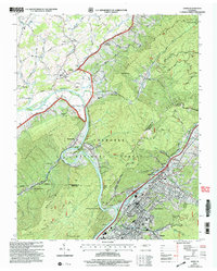
Historical Maps of Mayday Through Time
4 maps found