
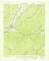
1935 Map of Erwin
USGS Topo · Published 1935About this map
The Clinchfield and Southern railroads anchor the industrial and social landscape of this Unicoi County region during the mid-1930s. The town of Erwin serves as a primary hub, while smaller communities like Embreeville and Lillydale are connected by a network of rural roads such as State Highway No 81. The topography is defined by the winding Nolichucky River, which carves through the terrain near The Horseshoe and past islands like Deakins Island.
Find a feature on this map
82 named features on this map. Tap any name to fly to it.
Don’t see what you’re looking for? This feature index may not catch every label — zoom into the map to look around manually.
Map Details
Editions of this 1935 Erwin Map
This is the sole edition of this map. No revisions or reprints were ever made.
Other maps of this area

1891 · Roan Mountain
USGS Topo · 1:125,000

1892 · Greeneville
USGS Topo · 1:125,000

1894 · Roan Mountain
USGS Topo · 1:125,000

1896 · Greeneville
USGS Topo · 1:125,000

1904 · Roan Mountain
USGS Topo · 1:125,000

1904 · Greeneville
USGS Topo · 1:125,000

1935 · Chestoa
USGS Topo · 1:24,000

1935 · Leesburg
USGS Topo · 1:24,000

1935 · Huntdale
USGS Topo · 1:24,000
1935 · Unicoi
USGS Topo · 1:24,000