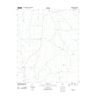
2012 Map of Eskridge
USGS Topo · Published 2012About this map
Eskridge and Sawyer anchor this rural Montgomery County landscape, where the terrain is defined by the winding paths of Eskridge Cr and Jackson Cr. The settlement pattern is deeply connected to family and community history, evidenced by a high density of burial grounds including Bethesda Cem, Hays Creek Cem, and Saint Johns Cem. While the modern road network follows historic corridors like Winona Stage Rd, the presence of the Montgomery Lookout Tower underscores the significance of the area's elevation and forested expanse. Genealogists will find particular value in the distribution of family-named landmarks such as Duck Hill Cem and Taylor Cem, which mark the transition between the watershed of Worsham Cr and the southern reaches near Fox.
Find a feature on this map
48 named features on this map. Tap any name to fly to it.
Don’t see what you’re looking for? This feature index may not catch every label — zoom into the map to look around manually.
Map Details
Editions of this 2012 Eskridge Map
This is the sole edition of this map. No revisions or reprints were ever made.
Other maps of this area

1953 · West Point
USGS Topo · 1:250,000

1954 · Duck Hill
USGS Topo · 1:62,500

1954 · McCarley
USGS Topo · 1:62,500

1958 · West Point
USGS Topo · 1:250,000

1963 · West Point
USGS Topo · 1:250,000

1966 · Kilmichael
USGS Topo · 1:24,000

1966 · Winona
USGS Topo · 1:24,000

1968 · Winona
USGS Topo · 1:62,500
1975 · Bailey Lake
USGS Topo · 1:24,000
1978 · Coila
USGS Topo · 1:62,500