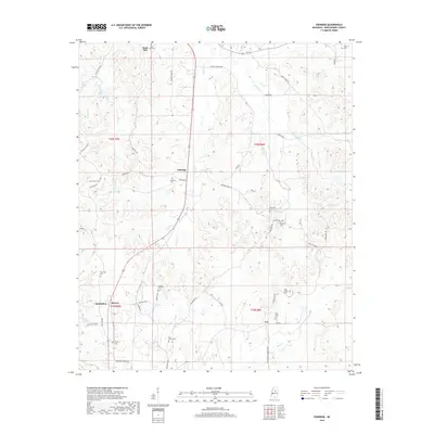
2018 Map of Eskridge
USGS Topo · Published 2018About this map
The northern edge of Winona and the rural communities of Montgomery County are documented in this 2018 survey. The landscape is defined by the prominent Dividing Ridge and the winding course of Eskridge Cr and Worsham Cr, which flow through the undulating terrain north of the city. Settlement patterns follow historic corridors like the Winona Stage Rd and Old Hwy 51 N, connecting small hamlets such as Duck Hill and Eskridge.
Find a feature on this map
52 named features on this map. Tap any name to fly to it.
Don’t see what you’re looking for? This feature index may not catch every label — zoom into the map to look around manually.
Map Details
Editions of this 2018 Eskridge Map
This is the sole edition of this map. No revisions or reprints were ever made.
Other maps of this area

1953 · West Point
USGS Topo · 1:250,000

1954 · Duck Hill
USGS Topo · 1:62,500

1954 · McCarley
USGS Topo · 1:62,500

1958 · West Point
USGS Topo · 1:250,000

1963 · West Point
USGS Topo · 1:250,000

1966 · Kilmichael
USGS Topo · 1:24,000

1966 · Winona
USGS Topo · 1:24,000

1968 · Winona
USGS Topo · 1:62,500
1975 · Bailey Lake
USGS Topo · 1:24,000
1978 · Coila
USGS Topo · 1:62,500