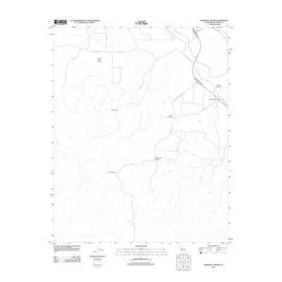
2012 Map of Espinosa Canyon
USGS Topo · Published 2012About this map
Rancho San Lucas serves as a central point of interest in this part of Monterey County, situated within a landscape defined by an intricate network of drainage systems. The Salinas River flows through the northern reaches, while the terrain to the south is deeply carved by numerous named geographic features, including Seven Well Canyon, Feliz Canyon, and McConnell Canyon. These canyons suggest a complex watershed and a history of ranching or land management adapted to the undulating topography of the region.
Find a feature on this map
15 named features on this map. Tap any name to fly to it.
Don’t see what you’re looking for? This feature index may not catch every label — zoom into the map to look around manually.
Map Details
Editions of this 2012 Espinosa Canyon Map
This is the sole edition of this map. No revisions or reprints were ever made.
Other maps of this area

1912 · San Ardo
USGS Topo · 1:31,680

1915 · Priest Valley
USGS Topo · 1:125,000

1919 · King City
USGS Topo · 1:62,500

1919 · Bryson
USGS Topo · 1:62,500

1919 · Bradley
USGS Topo · 1:62,500

1939 · King City
USGS Topo · 1:62,500

1941 · San Ardo
USGS Topo · 1:62,500

1941 · Bradley
USGS Topo · 1:62,500

1941 · Bryson
USGS Topo · 1:62,500

1942 · Bryson
USGS Topo · 1:62,500