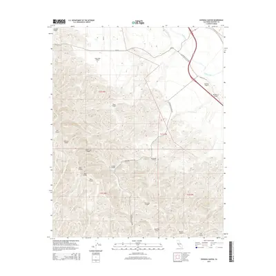
2015 Map of Espinosa Canyon
USGS Topo · Published 2015About this map
The Salinas River winds through the northeast corner of this territory, marking the transition from the alluvial valley floor to the steep, dissected slopes of the Santa Lucia Range. This landscape is defined by an intricate network of drainages and family-named landmarks, such as San Lucas Canyon, Robinson Canyon, and Espinosa Canyon. The rugged topography has historically dictated the path of human transit, with Lockwood San Lucas Rd and Oasis Rd following the natural contours and low passes between high ridges. Land divisions across the quadrangle are clearly delineated by Township and Range boundaries, including t21s r8e and t22s r9e. Smaller features like Feliz Canyon and Seven Well Canyon offer precise points of reference for those researching local land use or geographic history in this part of Monterey County.
Find a feature on this map
26 named features on this map. Tap any name to fly to it.
Don’t see what you’re looking for? This feature index may not catch every label — zoom into the map to look around manually.
Map Details
Editions of this 2015 Espinosa Canyon Map
This is the sole edition of this map. No revisions or reprints were ever made.
Other maps of this area

1912 · San Ardo
USGS Topo · 1:31,680

1915 · Priest Valley
USGS Topo · 1:125,000

1919 · King City
USGS Topo · 1:62,500

1919 · Bryson
USGS Topo · 1:62,500

1919 · Bradley
USGS Topo · 1:62,500

1939 · King City
USGS Topo · 1:62,500

1941 · San Ardo
USGS Topo · 1:62,500

1941 · Bradley
USGS Topo · 1:62,500

1941 · Bryson
USGS Topo · 1:62,500

1942 · Bryson
USGS Topo · 1:62,500