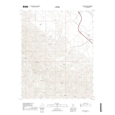
2018 Map of Espinosa Canyon
USGS Topo · Published 2018About this map
The Santa Lucia Range dominates the western topography of this Monterey County landscape, where deeply etched drainages define the transition toward the coastal mountains. To the east, the Salinas River cuts through the valley floor, paralleled by transportation corridors like Bunte Rd and Paris Valley Rd. This 2018 survey reveals a terrain defined by an extensive network of named canyons, including Seven Well Canyon and Espinosa Canyon, which reflect the historical ranching and land-division patterns of the region. The map captures the interface between the open agricultural valley and the complex ridgelines of the interior range, marking many family-named landmarks such as Loridon Canyon and Weferling Canyon that are central to local land-use history.
Find a feature on this map
30 named features on this map. Tap any name to fly to it.
Don’t see what you’re looking for? This feature index may not catch every label — zoom into the map to look around manually.
Map Details
Editions of this 2018 Espinosa Canyon Map
This is the sole edition of this map. No revisions or reprints were ever made.
Other maps of this area

1912 · San Ardo
USGS Topo · 1:31,680

1915 · Priest Valley
USGS Topo · 1:125,000

1919 · King City
USGS Topo · 1:62,500

1919 · Bryson
USGS Topo · 1:62,500

1919 · Bradley
USGS Topo · 1:62,500

1939 · King City
USGS Topo · 1:62,500

1941 · San Ardo
USGS Topo · 1:62,500

1941 · Bradley
USGS Topo · 1:62,500

1941 · Bryson
USGS Topo · 1:62,500

1942 · Bryson
USGS Topo · 1:62,500