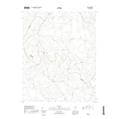
2019 Map of Essex
USGS Topo · Published 2019About this map
Fishing Creek and its many tributaries, including Little Fishing Creek and Powell Cr, carve a complex drainage pattern across the borderlands of Halifax and Nash Counties. This rural landscape is anchored by the small communities of Essex, Ita, and Aventon, connected by a network of winding roads like Aventon Gin Rd and Gold Mine Rd. The terrain is characterized by expansive wetlands and low-lying areas such as White Oak Swamp, Crooked Swamp, and Gideon Swamp, which have historically influenced settlement patterns and transportation routes.
Find a feature on this map
56 named features on this map. Tap any name to fly to it.
Don’t see what you’re looking for? This feature index may not catch every label — zoom into the map to look around manually.
Map Details
Editions of this 2019 Essex Map
This is the sole edition of this map. No revisions or reprints were ever made.
Other maps of this area

1953 · Norfolk
USGS Topo · 1:250,000

1953 · Greensboro
USGS Topo · 1:250,000

1954 · Greensboro
USGS Topo · 1:250,000

1962 · Greensboro
USGS Topo · 1:250,000

1963 · Ringwood
USGS Topo · 1:24,000

1963 · Red Oak
USGS Topo · 1:24,000

1963 · Essex
USGS Topo · 1:24,000

1963 · Drake
USGS Topo · 1:24,000

1966 · Greensboro
USGS Topo · 1:250,000

1971 · Inez
USGS Topo · 1:24,000