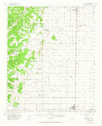
1956 Map of Estancia
USGS Topo · Published 1968About this map
Estancia and Moriarty anchor this high-plains landscape, situated along the Atchison Topeka and Santa Fe rail corridor. The mid-century geography is defined by a transition from the wooded heights of the Chilili Grant Boundary in the west to the open flats and dry washes of the Estancia Valley. The map records a rural economy of scattered livestock operations such as Milbourn Ranch, Tijeras Ranch, and Goodner Ranch, alongside industrial markers like Carbon Dioxide Wells and several Gravel Pits.
Find a feature on this map
57 named features on this map. Tap any name to fly to it.
Don’t see what you’re looking for? This feature index may not catch every label — zoom into the map to look around manually.
Map Details
Editions of this 1956 Estancia Map
2 editions found

Other maps of this area

1892 · San Pedro
USGS Topo · 1:125,000

1894 · Lamy
USGS Topo · 1:125,000

1917 · Estancia
USGS Topo · 1:125,000

1954 · Chilili
USGS Topo · 1:24,000

1954 · Torreon
USGS Topo · 1:24,000

1954 · Sedillo
USGS Topo · 1:24,000

1954 · Tajique
USGS Topo · 1:24,000

1954 · Escabosa
USGS Topo · 1:24,000

1954 · Edgewood
USGS Topo · 1:24,000

1954 · Milbourn Ranch
USGS Topo · 1:24,000