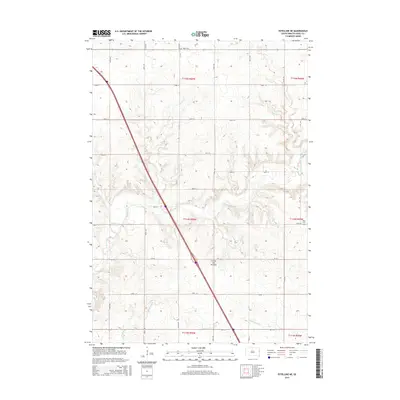
2015 Map of Estelline NE
USGS Topo · Published 2015About this map
Coteau des Prairies, the expansive upland plateau of the glacial drift plain, dominates this portion of Deuel County. The landscape is defined by the regular section-line grid of the Public Land Survey System, where local travel is managed by routes like 467th Ave and 187th St. Water drainage patterns follow the natural contours of the plateau, with Hidewood Cr and Bullhead Run cutting across the agricultural terrain. Genealogical markers of the early rural community are preserved at Tabor Cem in the north and Rose Cem near the eastern boundary, serving as quiet anchors for the surrounding townships of t114n r50w and t115n r50w.
Find a feature on this map
28 named features on this map. Tap any name to fly to it.
Don’t see what you’re looking for? This feature index may not catch every label — zoom into the map to look around manually.
Map Details
Editions of this 2015 Estelline NE Map
This is the sole edition of this map. No revisions or reprints were ever made.
Other maps of this area

1953 · Watertown
USGS Topo · 1:250,000

1958 · Watertown
USGS Topo · 1:250,000

1969 · Dempster
USGS Topo · 1:24,000

1970 · Kranzburg SW
USGS Topo · 1:24,000

1970 · Bemis
USGS Topo · 1:24,000

1970 · Clear Lake South
USGS Topo · 1:24,000

1970 · Estelline SE
USGS Topo · 1:24,000

1970 · Estelline
USGS Topo · 1:24,000

1970 · Estelline NE
USGS Topo · 1:24,000

1970 · Toronto
USGS Topo · 1:24,000