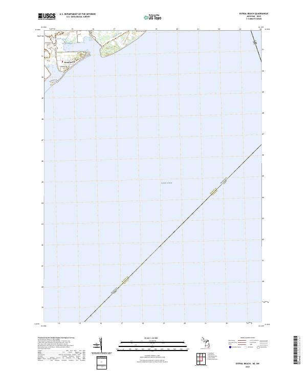
2023 Map of Estral Beach
USGS Topo · Published 2023About this map
Estral Beach sits at the edge of the Michigan shoreline, where the residential community meets the expansive waters of Lake Erie. This coastal enclave is defined by its proximity to the Detroit River International Wildlife Refuge, which preserves the marshy ecosystems at the mouth of Mouillee Creek. The map details the local road network connecting this lakefront settlement, including Lakeshore Dr and Center St, illustrating the concentrated development along the immediate coast.
Find a feature on this map
14 named features on this map. Tap any name to fly to it.
Don’t see what you’re looking for? This feature index may not catch every label — zoom into the map to look around manually.
Map Details
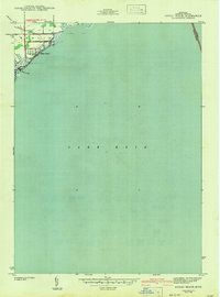
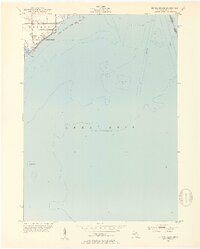
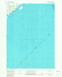
Editions of this 2023 Estral Beach Map
This is the sole edition of this map. No revisions or reprints were ever made.
Historical Maps of Estral Beach Through Time
4 maps found
Featured Locations
- Lucas County, OH
- Frenchtown Charter Township, MI
- Berlin Charter Township, MI
- Estral Beach, Berlin Charter Township