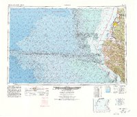
1958 Map of Eureka
USGS Topo · Published 1978About this map
Humboldt Bay and its complex network of shoreline settlements anchor this mid-century topographic-bathymetric study. The deep-water maritime infrastructure of Eureka and Samoa is contrasted against the dramatic submarine topography of the Mendocino Escarpment and Mendocino Canyon just offshore. This survey highlights the coastal transportation corridor before modern highway expansions reached their full footprint, showing the Northwestern Pacific railroad line threading through river valleys to serve the timber and dairy hubs of the Eel River delta. Inland, the transition from the pastoral flats of Ferndale and Loleta to the dense timberlands of Humboldt Redwoods State Park is clearly defined. Along the "Lost Coast," the King Range rises sharply from the sea, where landmarks like Cape Mendocino and the Table Bluff Lighthouse served as critical navigational aids for the Pacific shipping lanes.
Find a feature on this map
87 named features on this map. Tap any name to fly to it.
Don’t see what you’re looking for? This feature index may not catch every label — zoom into the map to look around manually.
Map Details
Editions of this 1958 Eureka Map
This is the sole edition of this map. No revisions or reprints were ever made.
Other maps of this area

1916 · Cape Fortunas
USGS Topo · 1:62,500

1919 · Glynn
USGS Topo · 1:62,500

1920 · Pt. Delagda
USGS Topo · 1:62,500

1921 · Dyerville
USGS Topo · 1:62,500

1921 · Briceland
USGS Topo · 1:62,500

1921 · Cape Mendocino
USGS Topo · 1:62,500

1922 · Eureka
USGS Topo · 1:62,500

1922 · Korbel
USGS Topo · 1:62,500

1922 · Kneeland
USGS Topo · 1:62,500

1925 · Hoopa
USGS Topo · 1:125,000