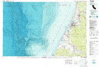
1987 Map of Eureka
USGS Topo · Published 1987About this map
Humboldt Bay and the complex tidal landscape of the Northern California coast define this 1987 study, which integrates detailed topographic data with the deep bathymetry of the Eel Canyon. The map illustrates the specialized infrastructure of the region, from the industrial corridors of the Northwestern Pacific RR to the academic hubs of Humboldt State University and the College of the Redwoods. Coastal settlements like Samoa, Manila, and Fairhaven line the Samoa Peninsula, while inland, the transition from urban centers like Eureka to the agricultural reaches of Sandy Prairie is clearly visible.
Find a feature on this map
83 named features on this map. Tap any name to fly to it.
Don’t see what you’re looking for? This feature index may not catch every label — zoom into the map to look around manually.
Map Details
Editions of this 1987 Eureka Map
This is the sole edition of this map. No revisions or reprints were ever made.
Other maps of this area

1916 · Cape Fortunas
USGS Topo · 1:62,500

1919 · Glynn
USGS Topo · 1:62,500

1921 · Dyerville
USGS Topo · 1:62,500

1921 · Cape Mendocino
USGS Topo · 1:62,500

1922 · Eureka
USGS Topo · 1:62,500

1922 · Korbel
USGS Topo · 1:62,500

1922 · Kneeland
USGS Topo · 1:62,500

1925 · Hoopa
USGS Topo · 1:125,000

1933 · Eureka
USGS Topo · 1:48,000

1942 · Eureka
USGS Topo · 1:62,500