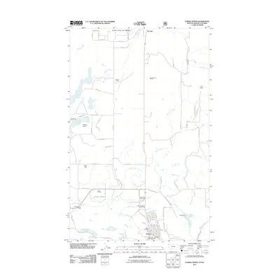
2011 Map of Eureka North
USGS Topo · Published 2011About this map
The Tobacco Plains define the geography of this northern Montana region, stretching across the border toward Canada. At the heart of the landscape sits Eureka, serving as a central hub with the Eureka Post Office and Lincoln County Fairgrounds. The town's layout is intricately detailed, showing the Eureka Vol Fire Dept and the crossing at Creek Bridge over the Tobacco River. To the north, the small settlement of Roosville marks the international boundary, while the surrounding terrain is dotted with diverse water bodies like Sophie Lake, Black Lake, and the man-made Costich Lake held by Costich Dam. This map captures a modern view of the local infrastructure, from the Eureka Cemetery to the recreational Tetrault Lake Campground, illustrating how the community has integrated with the numerous creeks and flats of Lincoln County.
Find a feature on this map
87 named features on this map. Tap any name to fly to it.
Don’t see what you’re looking for? This feature index may not catch every label — zoom into the map to look around manually.
Map Details
Editions of this 2011 Eureka North Map
This is the sole edition of this map. No revisions or reprints were ever made.
Other maps of this area

1913 · Stryker
USGS Topo · 1:125,000

1916 · Stryker
USGS Topo · 1:125,000

1957 · Kalispell
USGS Topo · 1:250,000

1960 · Kalispell
USGS Topo · 1:250,000

1961 · Kalispell
USGS Topo · 1:250,000

1963 · Rexford
USGS Topo · 1:24,000

1963 · Eureka North
USGS Topo · 1:24,000

1963 · Ksanka Peak
USGS Topo · 1:24,000

1963 · Eureka South
USGS Topo · 1:24,000
1963 · Fortine
USGS Topo · 1:24,000