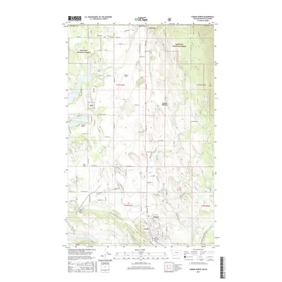
2017 Map of Eureka North
USGS Topo · Published 2017About this map
Eureka sits at the southern edge of this map, serving as a gateway to the international border at Roosville. This 2017 survey details the varied landscape of the Tobacco Plains, where the Tobacco River flows past the Tobacco River Bridge toward a series of water bodies including Sophie Lake, Moran Lake, and Tetrault Lake. The settlement pattern follows the Highway 93 corridor, connecting Indian Springs and Midvale through the Kootenai National Forest. Cultural and community markers are preserved in the positioning of the Eureka Cem and the Saint Clair Creek Bridge, while the residential expansion is evident in the network of roads like Roosevelt Rd and Glacial High Rd. This document is particularly valuable for its contemporary view of the intersection between established homesteads and the protected forest lands of the KNF.
Find a feature on this map
86 named features on this map. Tap any name to fly to it.
Don’t see what you’re looking for? This feature index may not catch every label — zoom into the map to look around manually.
Map Details
Editions of this 2017 Eureka North Map
This is the sole edition of this map. No revisions or reprints were ever made.
Other maps of this area

1913 · Stryker
USGS Topo · 1:125,000

1916 · Stryker
USGS Topo · 1:125,000

1957 · Kalispell
USGS Topo · 1:250,000

1960 · Kalispell
USGS Topo · 1:250,000

1961 · Kalispell
USGS Topo · 1:250,000

1963 · Rexford
USGS Topo · 1:24,000

1963 · Eureka North
USGS Topo · 1:24,000

1963 · Ksanka Peak
USGS Topo · 1:24,000

1963 · Eureka South
USGS Topo · 1:24,000
1963 · Fortine
USGS Topo · 1:24,000